

Eddy Covariance
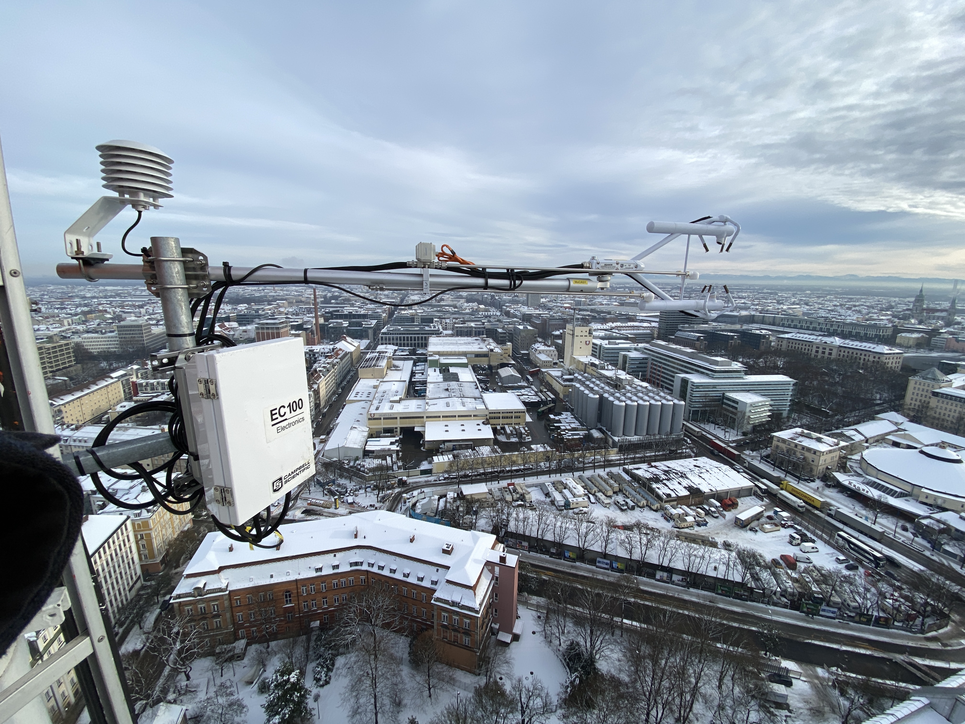
Eddy covariance is measured using sonic anemometers, which can measure wind, temperature and humidity. In addition, concentrations of trace gases, e.g. carbon dioxide (CO2), can be measured using infrared signals.
Since the measurements record data with a very high temporal resolution (20 Hz), turbulent parts of the flow and, by combining the measured variables, net transport of the turbulent flow (so-called fluxes) can be calculated.
This method allows direct measurements of energy, moisture, momentum and concentration fluxes and is of considerable importance for the quantification of CO2 balances, for example.
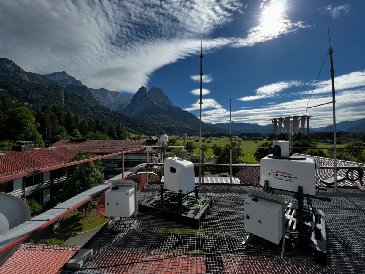
Doppler Wind Lidar

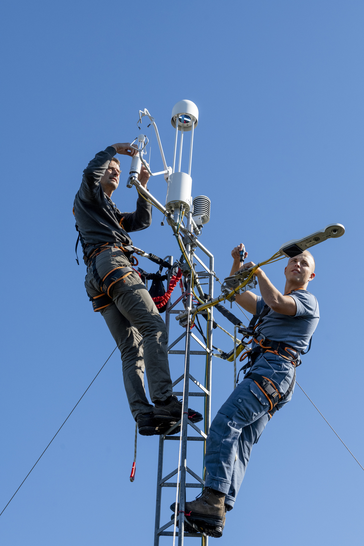
Doppler wind lidar systems are ground-based laser systems. The instruments measure the laser light that is backscattered by aerosols in the atmosphere. The time of flight of the light is used to determine the distance from the instrument, while the amount of scattered light provides information about the amount of aerosol in the backscattering layer. The speed at which the backscattering layer moves towards (or away from) the instrument can be determined by the change in wavelength (known as the Doppler shift). As the instrument is not moving, this shift can be interpreted as the wind speed of the backscattering air mass.
This measurement technique allows wind and aerosol to be measured from the ground up to a height of several kilometers. They are therefore particularly suitable for measuring wind in cities, where it is often not possible to erect sufficiently high towers.
Ceilometer
Ceilometers, like Doppler wind lidar systems, use lasers to measure the vertical distribution of aerosol in the atmosphere. The distance (height) of the backscattering air mass is determined by the instrument based on the transit time of the light signal between transmission and reception of the backscatter. The signal strength provides information about the number of backscattering particles. The polarization of the received light can also be used to determine whether the particles are water droplets or ice crystals.
In combination with radiosonde data and other profile information, ceilometers are a very useful tool to deduce structures of the atmospheric layers.
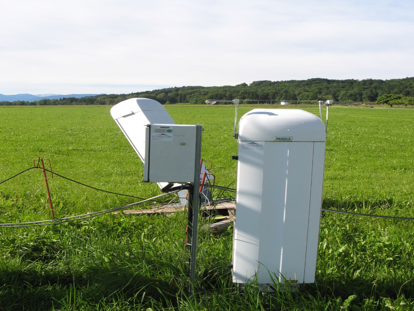
Pluvio precipitation measurements
The Pluvio measuring system is a classic "bucket" system that collects and weighs precipitation. The change in weight is then used to calculate the amount of precipitation. For comparison: the smaller sensors in classic weather stations often use optical methods to measure how many and how large drops fall through a tube. For more precise measurement of the actual amount of precipitation that has fallen, the weighing method is often more accurate.
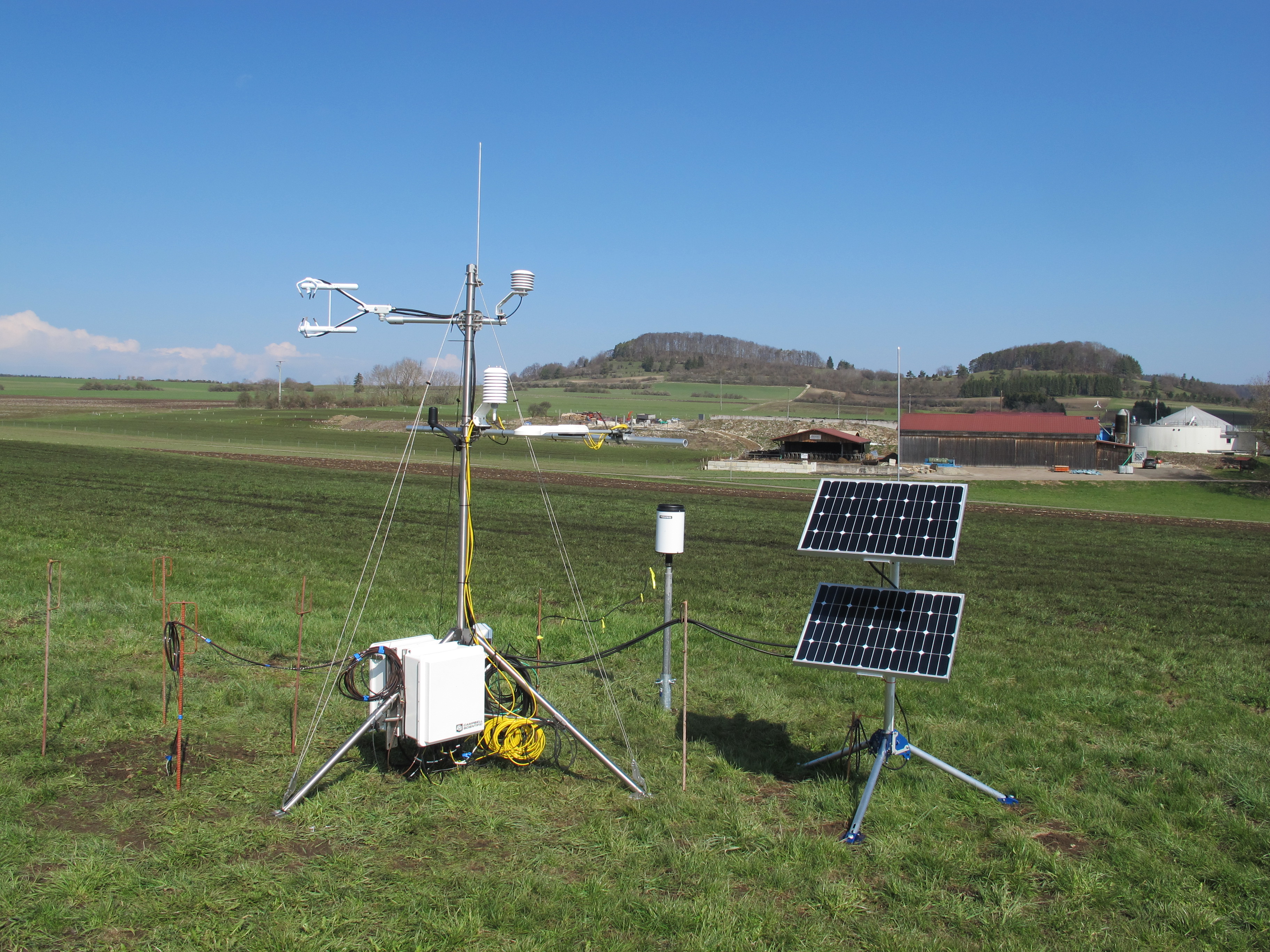
Mobile masts
For many meteorological studies, it is necessary to collect data at a greater height above the ground. We use a mobile 30 meter high measuring mast for this purpose. The mast can be extended pneumatically and must be securely braced. The maximum top load in calm conditions is 50 kilograms.
Modeling of effects
In order to make our findings usable for society, we develop cause-mechanism-effect models based on data and simulations. Digital information tools (so-called GIS plug-ins) are used to visualize data from complex models in a way that can be used by stakeholders to support decision-making. These tools are developed and improved together with our partners in order to meet the needs of the various stakeholders.
Theory and conceptualization
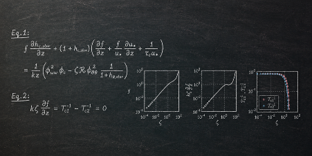
In order to make empirical findings transferable, we develop conceptual models based on observable data and mathematical relationships of the physical systems we are investigating. Without equations and formulas that are determined mathematically or empirically, computer models, for example, cannot make any predictions.
The picture above illustrates our investigation on the storage flux as an example. The storage flux, corresponding to disequilibrium between observed flux and actual surface-atmosphere exchange, poses a significant challenge in the representativeness of the measurement and actual emission at the ground surface.
PALM Model System

The PALM Model System is a modern microscale model for meteorological applications, including in cities. The model simulates a virtual land surface and the atmosphere that interacts with it. For this purpose, exchange processes with urban surfaces, vegetation and water are simulated, as well as physical processes that take place in the atmosphere itself: Momentum, energy, humidity, but also trace gases, pollen and other aerosols.
Our group has been involved in the development and evaluation of the model since 2016. We are currently using the model mainly to investigate local representativeness: how precisely, accurately and correctly can an urban space be simulated (and measured) and what does this mean for our campaign concepts and the verifiability of measures (e.g. greening in streets)? By finding and getting to know these limits, we can develop methods to extend or circumvent them.
Weather Research and Forecast Model
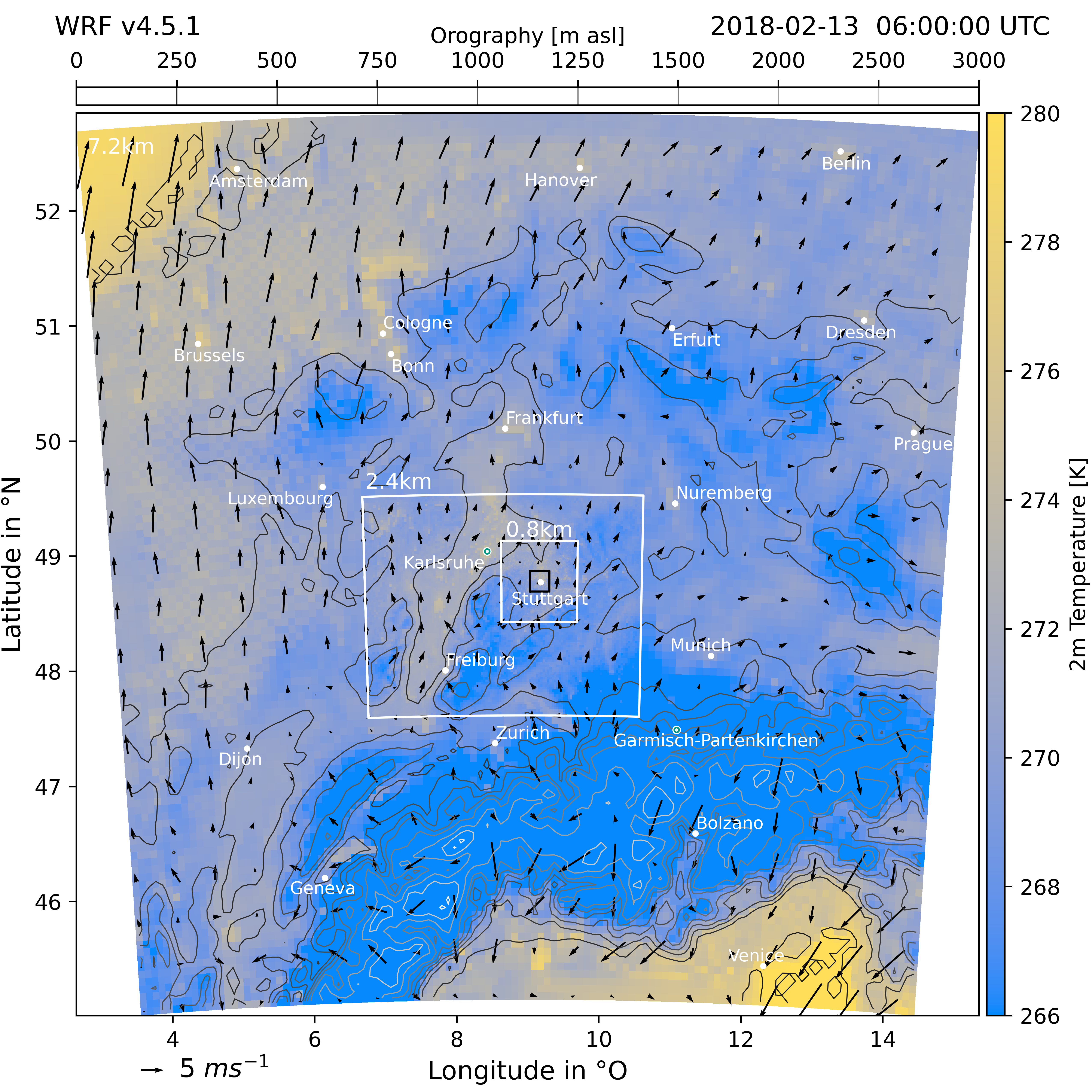
The Weather Research and Forecast(WRF) model is an established computer model for meteorology and climate research, which is also used for forecasting. In our working group, we mainly use it to calculate suitable initial and boundary conditions for PALM by downscaling reanalysis data (e.g. from the European Center for Medium Range Forecasts, ECMWF) to representative scales using a so-called dynamic downscaling process. Regional physical processes are explicitly simulated in order to make the results of the global models more representative. We evaluate the results of this process using our data before preparing them for PALM. This creates a model chain: global, data-driven reanalysis models into continental and regional process models. These then feed into locally representative microscale models. From global (thousands of kilometers) to human scales (a few meters).
Integrated Carbon Observation System

The Integrated Carbon Observation System(ICOS) is a European network with the aim of quantifying carbon dioxide fluxes across Europe. We currently operate two ICOS Associated Stations: Graswang and Fendt. The data flows into the data pipeline of the Ecosystem Thematic Center(ETC) and then into the central ICOS Carbon Portal.
Terrestrial Environmental Observatories


The TERrestrial Environmental Observatories(Tereno) network is a Helmholtz research infrastructure in which we participate in the Pre-Alpine Observatory. The Graswang, Fendt and Schechenfilz stations are maintained by our group and the data flows into the Tereno data portal.
Climate change adaptation at regional level
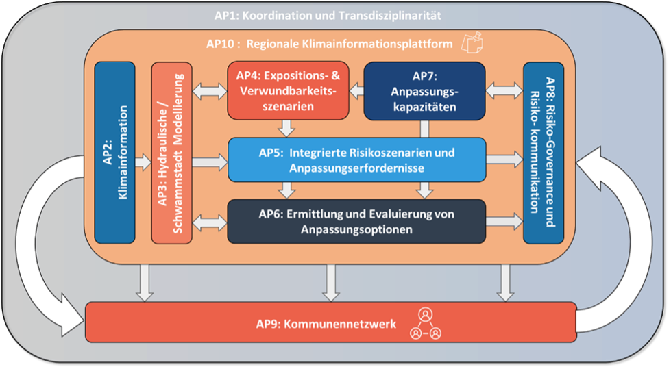
The joint project Climate Change Adaptation at the Regional Level (KARE) focuses on the transdisciplinary development, testing and dissemination of new methods for generating and providing relevant information for dealing with heavy precipitation and extreme heat events. In addition, the influences of climate change on future flood events at municipal level in the Oberland are to be quantified on the basis of improved regional climate projections.
Together with regional stakeholders in the Oberland region, KARE is developing practical knowledge on how municipalities can better plan for current and future heavy precipitation and extreme heat events. A mix of quantitative and qualitative methods and various modeling techniques are used for this purpose. KARE combines methods from the natural sciences, engineering and economics as well as methods from empirical social research.
We are responsible for the provision of regionalized and locally refined climate information and cluster maps on hydrometeorological extremes (heavy precipitation and heat) on the basis of existing climate data and data from the cross-sectional project (NUKLEUS). Changes in the heavy precipitation and heat statistics in the Oberland are derived from the climate data with the help of non-stationary extreme value analyses. These are crucial for improved hydraulic modeling and sponge city models. The aim of the information is to sensitize the population and the municipalities of the Oberland to the consequences of climate change, to provide data refined to the municipal level for climate impact analysis, to develop and test practical instruments for municipal heavy rain risk management together with actors from politics, business and society and to provide concrete climate information products (heat and heavy rain climate maps) for the digital information platform.
The project was funded by the German Federal Government.
Pilot Applications in Urban Landscapes

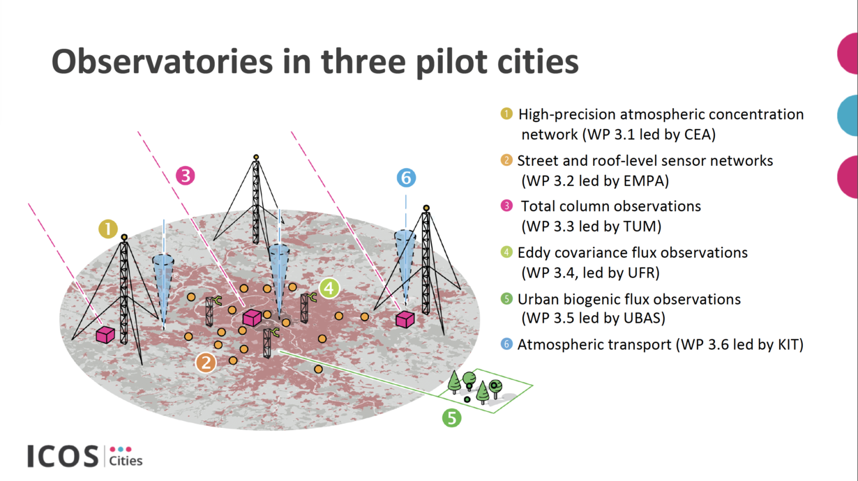
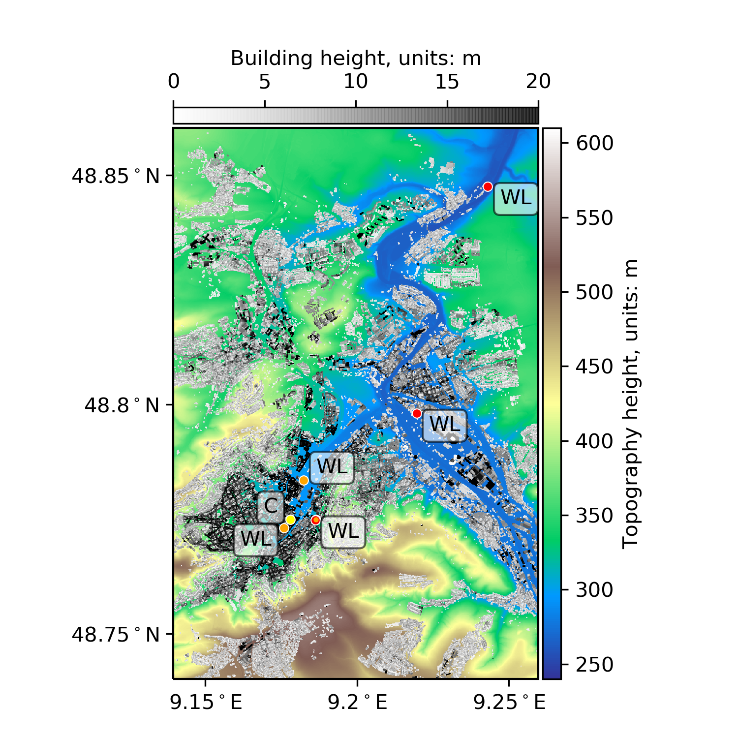
As part of the Pilot Applications in Urban Landscapes(PAUL, also known as ICOS Cities) project, we investigated what is needed to extend existing methods for measuring greenhouse gases across ecosystems to urban systems. We conducted pilot campaigns in Zurich, Paris and Munich and tested and evaluated the methods. We operated eddy covariance and Doppler wind lidar measurement systems in the three pilot cities and made the evaluation data available to the ICOS Carbon Portal.
The project was funded by the European Union.
Young Investigator Group Preparation Program
The Young Investigator Group Preparation Program (Yig Prep Pro) is aimed at young scientists who want to set up their own independent research group at KIT.
Dr. Hawwa Kadum joined this initiative in 2021 with the research topic Land - Atmosphere Feedback over Heterogeneous Surfaces.
Urban climate under change
![]()
.jpg)
In the project Urban Climate under change ([UC]2), we contributed to the development and evaluation of the PALM model system. In 2017 and 2018, we collected evaluation data in Stuttgart using Doppler wind lidar and ceilometer systems, which we later used to evaluate wind conditions and the general dynamics of the boundary layer structure within the model. In addition, our group made significant contributions to the development of the modules for atmospheric chemistry, biogenic emissions of gases and pollen, and building emission processes.
The project was funded by the German Federal Government.