

Research Questions
What exactly do urban measurements and simulations represent?
What are we actually measuring/simulating?
With every measurement, it is important to know exactly what is being recorded: In some cases, the spatial and temporal resolution can produce interesting properties. Point measurements behave differently from line measurements, and fast and slow responses interact with these differences: in fluid mechanics, space and time are always coupled via velocity (wind) fields. Consequently, the interpretation of data requires knowledge of the location, the measuring devices and the conditions, even if the measuring devices themselves are well calibrated and free of other biases and errors.
The same concept applies to numerical models: aggregation, model formulation and resolution influence which effect scales can be simulated.
We collect data and run simulations to characterize how well the numerical models can simulate phenomena such as katabatic flows interacting with urban heat islands and the transport of air pollutants such as particulate matter or nitrogen oxides (NOx). We also observe properties of the system within the models that help us to identify gaps in our measurement strategies. This symbiotic process helps us to characterize and quantify the limitations of both the numerical models and the measurement techniques in order to subsequently develop strategies for improvements in both areas.
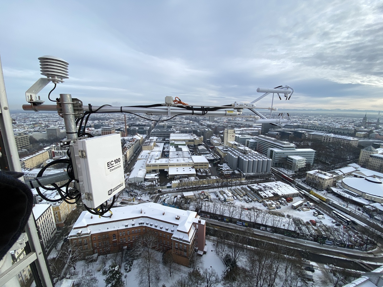
How can urban turbulent flows be measured and interpreted correctly?
How precisely can we determine urban rivers?
To calculate turbulent fluxes, we need a reliable aggregation to quantify the fluctuations. This aggregation involves several steps, most of which have been developed for ecosystem sites that are relatively flat and homogeneous (the internal means are larger than the internal variances). In practice, this means that these methods may be difficult to apply in urban areas, as it cannot be guaranteed that the required assumptions are met under many conditions.
For this reason, we investigate the limitations and applicability of the eddy covariance method. We have investigated the effects of different processing methods and evaluated how coupling within the boundary layer affects the quantification of fluxes.
To conduct this research, we operate a site with a tall measurement mast in Munich (see Methodology) equipped with a Doppler wind lidar and collaborate with several partners. This research began as part of the ICOS Cities project (see Projects).
How does urban green infrastructure affect air quality?
Trees in the city help us, don't they?
It is well known that in many climates, trees in cities improve the local climate by providing shade and humidity. However, there are also other effects: in narrow streets and courtyards, trees have an important influence on air flow and thus the transport of heat, moisture and air pollutants. Trees themselves can also be sources of trace gases or pollen.
Does this mean that trees may do us more harm than good in cities? In order to be able to investigate these difficult dynamics, we have developed models that allow us to examine the interaction in detail. (see Methodology).
How does urbanization influence spatial and temporal relationships between cause and effect?
When a cause (e.g. a thunderstorm) enters an urban space, how do the characteristics of the urban space have on the manifestation of the effect? Specifically, using the example of a thunderstorm, we investigate how precipitation changes, which factors influence this change and what consequences can be derived (flooding, lightning, etc.). One of the aims is to develop tools that can be used to make these scientific findings easier to apply in real life. A concrete example was an analysis of fire department operations in connection with heavy rainfall, which then provides information for the administrations using a GIS tool as to which areas are particularly at risk. (see here)
Collaborations
Das Team des Deutschen Wetterdienst hat Daten für einige unserer Evaluationen von PALM bereitgestellt. Außerdem fließen unsere Temperaturmessungen in München in den Urbanen Wärme Atlas ein.
Together with Prof. Yueyang He, we are working on projects to systematically measure urban wind fields with Doppler Wind Lidar, and to assimilate them into urban meso- and microscale models to provide more accurate wind profiles for architectural analysis of wind load in complex terrain.
Gemeinsam mit den Teams von Prof. Dominique Derome, Prof. Jan Carmeliet und dem Hong Kong Observatory arbeiten wir an einem Modellvergleich von WRF, PALM und Urban MicroFOAM für Hong Kong und einer Evaluation mit dem dichten Messnetz des HKO.
This collaboration between Prof. Jia Chen's group and our research group is about the exchange of experiences and data of urban river and wind measurements in Munich (see methodology). In addition, we support the TUM team in using the data for their air quality simulations with the numerical models WRF, PALM and GRAM-GRAL.
The recently founded Environmental Health Sciences Institute at the University of Augsburg is concerned with research into the effects of air quality on human health, among other things. To this end, Prof. Christoph Knote's group is collaborating with our research group to make PALM simulations of aerosols and pollen usable for epidemiological purposes and for open source applications such as air quality apps.
Prof. Natascha Kljun's team in the Department of Earth and Environmental Sciences calculates flux footprints, which we can use to determine the representativeness of our eddy covariance measurements for the environment. This collaboration allows us to relate our point measurements to source sectors.
Together with the teams of Prof. Dominique Derome, Prof. Jan Carmeliet and the Hong Kong Observatory, we are working on a model comparison of WRF, PALM and Urban MicroFOAM for Hong Kong and an evaluation with the dense measurement network of the HKO.
Together with Prof. Matthias Mauder's team, we are working on methods for simulating and observing turbulence and expanding our understanding of heterogeneity.
Together with the teams of Prof. Dominique Derome, Prof. Jan Carmeliet and the Hong Kong Observatory, we are working on a model comparison of WRF, PALM and Urban MicroFOAM for Hong Kong and an evaluation with the dense measurement network of the HKO.
We are working with the Moor Research Institute to measure carbon fluxes in connection with the rewetting of the moor near Benediktbeuern.